05 Čvn

A place on the map, or POI (Point of interest) may be just a pin with a name.
Or it can be an information-rich page with a lot of information. After our experience with testing several map projects, we tried to create Mapotic in a way that it can be used with a wide range of options. Therefore, in our concept, each site needs to have its GPS, name and picture only, and everything else is optional. If there is no image added by the user, an aerial view (orthophoto map) of that location is displayed.
So, if you create a new map, it’s first necessary to define what information you want to record on the map. Typically, this may be a place description, address, opening hours, contact details. Or maybe you want to organize the information in a way that gives users the opportunity to take advantage of the filtering features according to the parameters that they (or others) set. We call this information Attributes, and at the moment we have several types of Attributes in the system.
Name, icon, and attribute value
It is important to correctly select the icon and name of the attribute. Be aware, that for example on small screen of mobile device it may not display the name of the attribute, but only the icon. So, you might need to be clever when naming an attribute, for example Paid entrance and give options Yes and No. Better choice would be to name it Entrance and use options Paid and Free.
Currently, the system supports over 1,000 icons, but it is possible that not everybody finds the right choice for their attributes. In that case, let us know and we’ll add the new icon. You can search for inspiration, for example on www.thenounproject.com or other services.
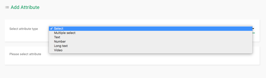
Attribute Select
This attribute means that you do not want to fill in the text when adding place, but choose one of the options. For you or your users, this option is displayed as a selection in the map interface when adding a place, and the user must enter one of the options offered. Only one option can be selected – ideally suited for types of information where only one option is always available.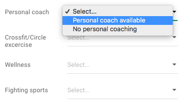
Attribute Multiple select
It works much like the Selection attribute, but you can choose from multiple options. It is therefore suitable for types of information where multiple conditions can be met at one time – for example, availability of services, products etc.
Attribute Text
This attribute creates a text field for the input of a single-line text in the entry field. It is typically used for short and clear information such as the name of the city or in situations where you want the user to fill in the brief information. If you type a link in the text, including „http://“, an active clickable link will be created that will create a new window.
Attribute Long text
This is a multi-line text. It is often necessary to fill in a longer description or even a few paragraphs of the text. Typically for different site descriptions or more detailed information. Again, links with „http: //“ will work
Attribute Number
Where there is a need to fill out a number that will filter the map. For example, it might be the capacity or the different numbers of items available on the site.
Attribute Video
You can also add YouTube videos to maps. Simply fill in the YouTube video address and the video window will automatically appear on the map.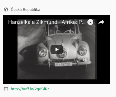
Attributes create filters
You may be wondering what is it good for. The answer is simple – if you register these attributes at a location, the system automatically generates the option to filter them on the map. Users can only, if they want, see those places that match their requirements. More in the article Filtering and categorizing places.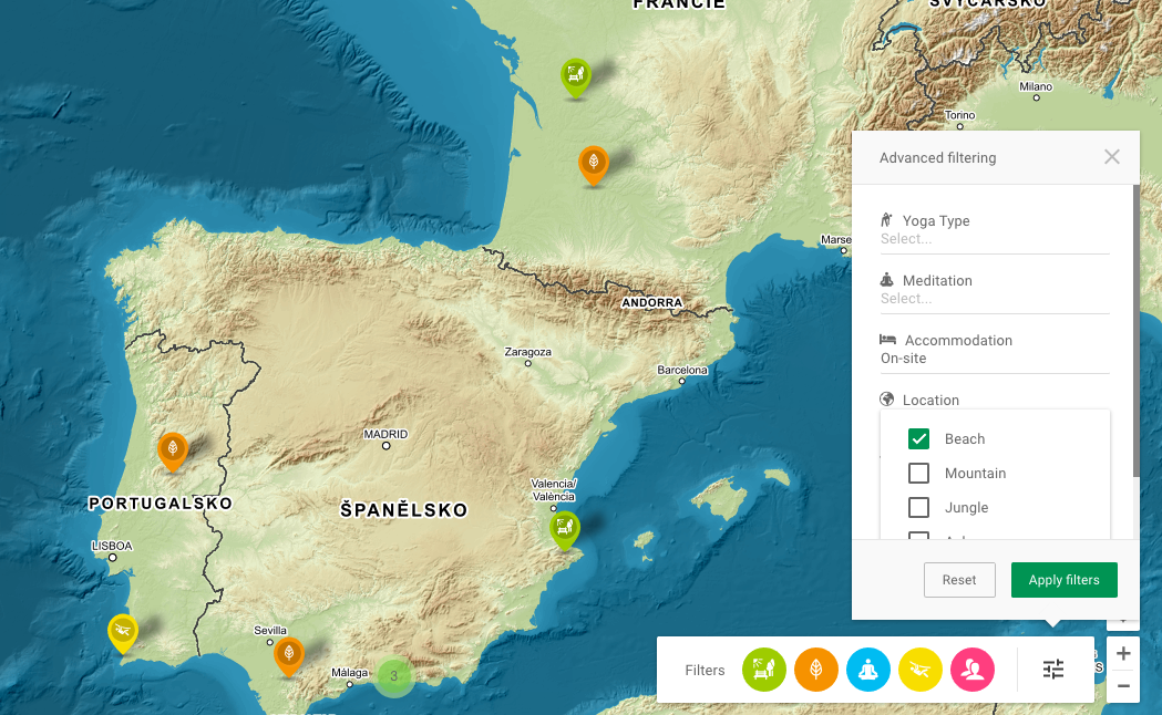
In the future, we plan to add additional attributes – we are going add that are used the most like Address, Opening Time, or Email. At the same time, the current set of attributes allows very flexible mapping.
If you add new attributes to an existing map, the new attribute will have no value for the places that were specified before it was created. Therefore, the values for these newly added attributes must be manually edited in the old places by editing each place. That’s why it’s so useful to think of categories and attributes in advance.
If the attribute doesn’t have filled value (by the user or by the administrator), the line with the attribute will not be displayed on the web map detail.